Traveling to and around Merced benefits from advance planning, as it is not a major metropolitan area. We recommend using a car for the most convenient and reliable transportation, as ride-share services are limited during the summer.
The information below outlines available travel options, both for getting to Merced and getting around Merced. Please do your own research before finalizing your plans.
Refer to the Travel Planning Guide and General Schedule for key conference start and end times.
Getting to Merced
From efficient routes to scenic roads, explore ways to travel here.
By Air
Fresno Yosemite International Airport
The closest major airport to UC Merced is Fresno Yosemite International Airport (FAT), located a ~1-hour drive from campus. From the airport, several ground transportation options are available:
- Rental Car: This is the most convenient option for travel to and around Merced. From FAT, drive to Merced.
Amtrak Rail Connection: Travel from Fresno Station (FNO) to Merced station (MCD) via Amtrak Gold Runner. You’ll need to take a taxi, rideshare, or bus from the airport to reach the Fresno Station.
To get to Amtrak Fresno Station from FAT:
- Rideshare or Taxi: ~15-minute drive; services are more readily available in Fresno
- Public Transit (either from bus shelter across the terminal or nearby bus stop):
- Fresno Area Express (FAX): Routes 22, 26, 39 (frequent service; may require transfers; up to ~1 hour travel time)
- Fresno County Rural Transit Agency (FCRTA): Route Coalinga Transit (limited service; runs once daily; up to ~20 minutes travel time)
- Yosemite Area Regional Transportation System (YARTS): Route Highway 41 (limited service, runs twice daily in early morning and late night; up to ~20 minutes travel time)
Merced Regional Airport (from LAX)
Attendees traveling from Los Angeles may consider flying from LAX Airport to the Merced Regional Airport, located a ~25-minute drive from UC Merced. This is a smaller airport with only one flight to Merced at the same time every day. Flights are operated by a 30-seat regional jet aircraft.
Starting July 1, 2026, Contour Airlines will be the main service provider for travel between LA and Merced. Use this airline to book your plane ticket.
From the airport, you'll need to walk ~15 minutes to the nearest bus stop on West Avenue at 1st (Southbound) and take The Bus to get to campus or downtown Merced.
By Rail
Amtrak provides services to Merced Station (MCD) on the Amtrak Gold Runner line from several major California cities and airports:
- Fresno: Take a rideshare, taxi, or public transit from Fresno Yosemite International Airport to Amtrak Fresno Station (FNO). Ride to Merced Station (MCD).
- Los Angeles: Take the Flyaway Bus from LAX Airport to Amtrak Union Station (LAX). Ride to Merced Station (MCD).
- Sacramento: Take a rideshare, taxi, or public transit from Sacramento International Airport to Amtrak Sacramento Station (SAC). Ride to Merced Station (MCD).
- Oakland: Take the BART connector from the Oakland International Airport Station to BART Coliseum Station. Ride the BART Orange line until you reach the BART Richmond Station. Walk to the Amtrak Richmond Station (RIC) and ride to Merced Station (MCD).
- San Francisco: Take the BART Red line from the San Francisco International Airport’s International Terminal until you reach the BART Richmond Station. Walk to the Amtrak Richmond Station (RIC) and ride to Merced Station (MCD).
Please plan ahead and make reservations as needed. Please use a map application (e.g. Google Maps or Apple Maps) to estimate travel times and determine the best routes.
Upon arrival to the Amtrak Merced Station, use The Bus to get to UC Merced or downtown Merced. Rideshare availability in Merced is limited during the summer, so plan accordingly.
By Road
Merced is best reached via Highway 99. Set your map application to UC Merced at 5200 North Lake Road, Merced, CA 95343.
UC-affiliated attendees can use ConnexUC to reserve rental cars at discounted rates.
From Northern California
- Head southeast on CA-99 South.
- Take Exit 187B toward Martin Luther King Jr. Way.
- Turn left onto CA-59 North/Martin Luther King Jr. Way.
- Take the third right onto West 16th Street.
- Take the third left onto G Street.
- Turn right onto East Bellevue Road.
- Turn left at Lake Road.
- Arrive at the main entrance to the UC Merced campus.
From Southern California
- Head northwest on CA-99 North.
- Take exit 187A for G Street.
- Turn right onto G Street.
- Turn right onto East Bellevue Road.
- Turn left at Lake Road.
- Arrive at the main entrance to the UC Merced campus.
Getting Around Merced
Please use the live shuttle trackers below or a map application (e.g. Google Maps or Apple Maps) to estimate travel times and determine the best routes.
Rental Car (Recommended)
A rental car is the most reliable way to get around Merced. UC-affiliated attendees can use ConnexUC to get discounted rates with certain car rental services. In downtown Merced, you can rent a car with Enterprise Rent-A-Car at 1334 W Main St, Merced, CA 95340.
The Bus
Merced’s regional transit system is known as The Bus, and it has several routes to the Amtrak Merced Station, campus, and downtown. You can see real-time locations on The Bus Live Shuttle Tracker.
Those who are staying at El Capitan Hotel can take the UC Merced Route via the K Street at 18th MCAG stop to the Amtrak Merced Station (MCD) and UC Merced University Transit Center.
Those who are staying at our other recommended hotels can take The Bus's M5 Route to the Amtrak Merced Station. Then transfer to the UC Merced Route until you reach the UC Merced campus University Transit Center.
Riding The Bus will be free for the month of July!
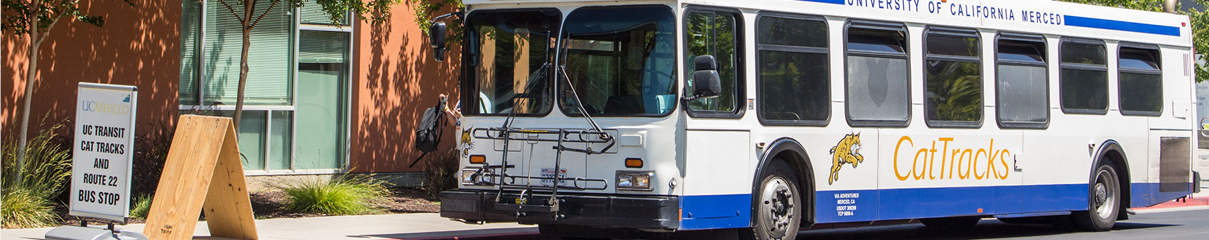
CatTracks
CatTracks is the bus service offered by UC Merced for its campus community. You can see real-time locations on the CatTracks Live Shuttle Tracker.
To get from campus to downtown Merced, take the BobCat Express or Route G from the UC Merced University Transit Center to the Amtrak Merced Station or downtown Merced via K St. & 18th St. & 19th St.
To use the CatTracks service, students, staff, and faculty must have their CatCard with them at all times. People who are not affiliated with UC Merced can still use the CatTracks service for $2 per ride.